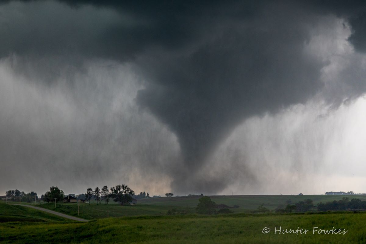
Iowa State students studied this tornado near Carbon, Iowa, and other storms across "Tornado Alley" during Iowa State's new course, "Field Observations of Thunderstorms." Larger photo. Photo by Hunter Fowkes.
AMES, Iowa – A class of Iowa State University storm chasers abandoned a remote ridge near Carbon, Iowa, and started driving south to get out of the way of an approaching tornado.
As they headed to the next intersection, a huge, wide and dark funnel loomed over a house surrounded by farm fields. When they cleared a small hill, the tornado came into full view, on the ground, throwing debris.
“Oh my God,” said one of the students.
“Wow,” said another. “Nice stovepipe.”
“OK, that tornado is less than a mile, go left.”
Rain began to hit the windshield. The wipers started.
“Slow down. Slow down. Slow down. That tornado is, in fact, coming this way.”
“We got twins,” a student said as the vehicle stopped on the road. Then, he shouted to classmates in a trailing vehicle, “There’s a second tornado! Due south.”
“That might be anticyclonic,” said a student, referring to tornadoes that rotate atypically. In the Northern Hemisphere, that’s clockwise.
“Yeah, it’s on the south side of the horseshoe,” said another student. “Definitely is.”
Tracking weather data and mental health
That’s two minutes and 22 seconds from a week on the road with a new Iowa State course, “Field Observations of Thunderstorms,” as captured on video and posted to YouTube by Bryce Bruggeman, a student in the class and a senior from Gilbert, Iowa, studying meteorology.
The clip could have been straight out of the 1996 movie “Twister” or this summer’s sequel, “Twisters.”

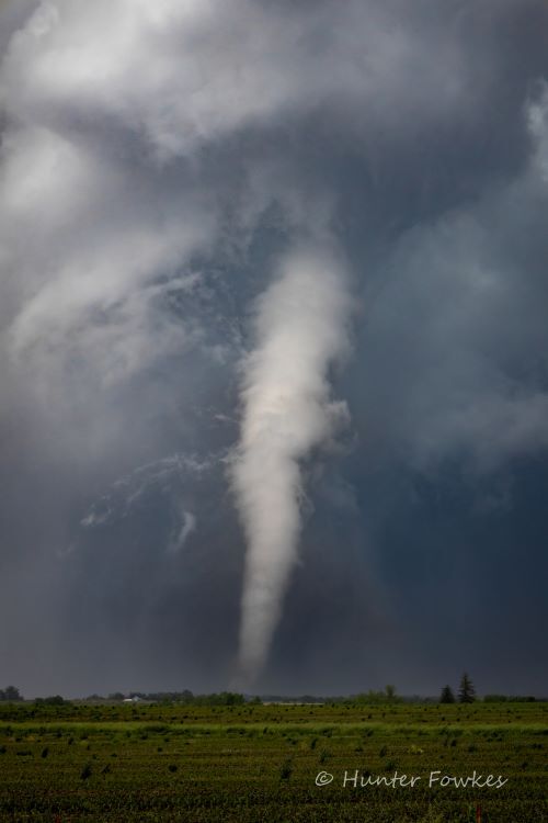
A tornado near Carbon, Iowa, as photographed by Hunter Fowkes on May 21st.
“It ended up being a crazy week,” said Bill Gallus, a professor of geological and atmospheric sciences and one of the course’s three instructors. “People from other schools are reaching out to ask how we managed to get such a perfectly crazy weather week for our field trip.”
The class began in early March and met weekly through the rest of the semester for classroom lectures about storm formation, safety protocols and spotter training. Then, 13 students hit the road for eight days in search of storms.
They started in central Kansas. Then off to northeastern Colorado. Followed by southwest Iowa. Southwest Kansas. A tour of the national Storm Prediction Center in Norman, Oklahoma. And finally, running with storms in northern Oklahoma to southwest Missouri.
When they approached threatening weather, the students launched small weather balloons to collect atmospheric data, including temperature, humidity and wind readings.
Learning to use all that information and even sharing it with National Weather Service forecasters was a highlight for Hunter Fowkes, a student in the class and an experienced storm chaser who has seen more than 100 tornadoes.
“Weather is such a chaotic force,” said Fowkes, who’s from Parker, Colorado, just graduated with a degree in meteorology and is about to take a job forecasting for the energy industry. “It’s incredible we can predict a good portion of it.”
For Bruggeman, who hopes to work in emergency management, the experience was about more than science. It was also about physical and mental health.
All the driving was physically exhausting, he said. And, because he has relatives in Greenfield, Iowa, which was devastated by a tornado the students spotted, but didn’t follow, the chasing was also mentally stressful.
Except for some damage to a house, Bruggeman said his Greenfield relatives weren’t harmed by the storm. But there’s still a lot to clean up and process.
The big lesson for him was to “prioritize mental health,” Bruggeman said. “This was a long, grueling trip and storm chasers do it often, sometimes as first responders to these huge, damaging storms. It can definitely take a toll on somebody’s mental health.”
Lessons for the chase
In April, Allan Curtis with the National Weather Service in Johnston, Iowa, led an advanced spotter training for the class. Students looked at photos and videos from storm chasers, comparing on-the-ground visuals to radar and discussing safety.
One of the videos was taken by two amateur storm chasers in 2008 near Little Sioux, Iowa, near the Missouri River.
“Not much of a road network in that area. They could only go forward or back,” Curtis said.
He added that lots of precipitation and trees made it hard to see. Then the radar data stopped feeding, which meant they had outdated information about the tornado that was forming. The storm chasers made it out unscathed, but it was a close call.
Curtis and the students talked about positioning vehicles and avoiding areas with low visibility and few escape routes.
Where do we start?
At the end of May, the course’s three instructors picked a route based on the weather systems between Canada and Mexico, Denver and Chicago. The students loaded into two SUVs and one pickup truck with a tank of helium to launch weather balloons.
Dave Flory, a co-instructor and a Louis Thompson Distinguished Undergraduate Teacher, says many of the students have chased storms on their own or with more experienced classmates. But this trip provides more structured learning.
“The idea was to give students some experience deploying instruments and taking field measurements around the storm, and to help them think a little more scientifically about what’s happening,” said Gallus. “With an instructor in each vehicle, everything becomes a teaching moment.”
Gallus has chased storms for decades – often with Flory – and participated in research projects linked to the federally funded VORTEX1 and VORTEX2 tornado projects in the mid-1990s and 2009-2010.
Storm chasers needed
While radar is invaluable in forecasting, Gallus says it doesn’t catch everything.
“There are so many times when radar will make it look like there’s a tornado on the ground, and there isn’t one. Or situations where radar makes you think there couldn’t possibly be a tornado and then people report it,” said Gallus.
Lindsay Maudlin, a class co-instructor and an assistant teaching professor in geological and atmospheric sciences, adds that there are gaps in radar coverage. Since the equipment is expensive, most radar is operated from National Weather Service offices in cities.
“The radar beam goes up, but because the earth is round, the further you get from the radar, you miss more space near the ground, and with tornadoes, that’s where they’re the strongest, right near the ground,” said Flory.
A career edge
The instructors say the storm chasing class gives students a competitive edge as they prepare for forecasting careers. Often, these are with government agencies, such as the National Oceanic and Atmospheric Administration and the National Weather Service.
But Maudlin says many go into the private sector. Pro football teams, for example, hire their own forecasters. Another big area for students is broadcasting and emergency management.
Flory says the meteorology program at Iowa State is rigorous. During their first two years, students take the same math and physics classes as engineers. But enrollment is growing. More than 20 students graduated in the spring.
“We are a destination major,” said Flory. “Over half of our undergrads are from out of state – California, Texas, Washington and around the Midwest.”
Gallus says the original “Twister” film spiked interest in meteorology programs across the country. With the sequel coming out in July, Gallus is preparing for a similar surge.
Contacts
Bill Gallus, Geological and Atmospheric Sciences, 515-294-2270, wgallus@iastate.edu
Dave Flory, Geological and Atmospheric Sciences, 515-294-0264, flory@iastate.edu
Lindsay Maudlin, Geological and Atmospheric Sciences, 515-294-2343, maudlin@iastate.edu
Hunter Fowkes, Meteorology graduate, hfowkes@iastate.edu
Bryce Bruggeman, Meteorology student, bryce26@iastate.edu
Mike Krapfl, News Service, 515-294-4917, mkrapfl@iastate.edu
The 13 students in this spring's "Field Observations of Thunderstorms" class are: Front row, left to right, Josh Franson, Erin Brunsen, Nicole Skalicky, Bryce Bruggeman, Ryan Dreeszen and Zach McDaniel. Back row, left to right, Nico Sanchez, AJ Rickman, Lucas Prokosch, Ron Kouski, Nick Francis, Hunter Fowkes and Grace Hansen. Larger photo.
Quick look
A new course this spring, "Field Observations of Thunderstorms," took 13 Iowa State students and their three instructors across "Tornado Alley" for eight days. They found storms, collected data and shared information with national forecasters. It all could have been straight out of the 1996 movie “Twister” or this summer’s sequel, “Twisters.”
Quote
“It ended up being a crazy week. People from other schools are reaching out to ask how we managed to get such a perfectly crazy weather week for our field trip.”
Bill Gallus, Geological and Atmospheric Sciences
See more
Hunter Fowkes – meteorologist, storm chaser and photographer – sells storm images at The Real World Photography.
Bryce Bruggeman, an Iowa State meteorology student, has a YouTube channel featuring some of the storm chasing by the “Field Observations of Thunderstorms” class.
Storm chasing dialog
The dialog quoted in this story can be found on this video by Bryce Bruggeman from 3:22 to 5:44.
Credit
Rachel Cramer contributed to this story.
